The Hike to Tom's Thumb
- Apr 8, 2019
- 4 min read
Updated: Aug 18, 2022
Located in Scottsdale, AZ, Tom's Thumb is a giant granite spire that sits at the top of a high ridge on the northeast side of the McDowell Sonoran Preserve. The trails leading up to this iconic formation offer some of the best hikes in the area, and this one directly to Tom's Thumb is one of my personal favorites!
Overview:
Length: 4.3 miles out and back | Level: Moderate - Hard | Duration: 3-4 hours | Elevation: 1236 Dogs: Yes on leash | Parking: Free at the trailhead

Quick Trail Tips:
The hike to Tom's Thumb is best October- March. The weather is cooler during this time of year, but the trails are accessible all year round.
This hike is considered hard due to the steep ascent the first 2 miles -wear sturdy hiking shoes like these that I have from Salomon.
Hiking poles - they aren't necessary but are very helpful in certain areas. I did not use poles but many other hikers did especially on the way down as certain areas are a bit steep with loose gravel.
Dress in light layers- it is hot while hiking but breezy at the top when you reach Tom's Thumb.
Bring a camelback or plenty of water as even in the cooler months it still gets hot on the initial ascent. There are several signs located on this trail that say no water.
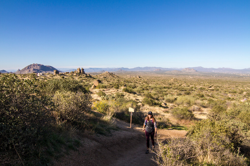
Begin at the trail-head, which is right off the main parking lot where you will find a small center with bathroom facilities and maps. You will notice that other trails also connect and branch off here, but proceed and follow the directions for Tom's Thumb. This trail is very well marked, so throughout the hike you'll see signs and markers like this making it easy to stay on course.


I started this hike around 1pm, planning for the sunset on the way down as it does take 2-3 hours if you take your time. As mentioned the first part of this hike is quite strenuous so you may want to go slower and enjoy yourself. It definitely took me longer to reach the top then it did coming down - I'm on the slow side for uphill hiking!


The ascent continues for about 2 miles before it levels off. It is not unbearable though because there are several beautiful viewpoints where you can stop off and rest and soak in the all beauty of Arizona. On a clear day this place looks incredible! The payoff on this trail is most certainly worth the effort to get there.

The first of two really great view spots (above photo), puts you about a mile in. Here you can start to see the parking lot and visitor area behind you from the start of the trail. The second view spot doesn't look much different than this, only that you are a bit higher up and you've covered a few of the more difficult switchbacks. You will also notice as you progress that this trail is often more crowded in the beginning and end. As many different level hikers attempt this, the crowded factor tends to space out with the climb up.

At just over the halfway point on this trail, you come to a nice valley that levels off just a bit before you start the final stretch up to Tom's Thumb. You can clearly see the landmark in the distance at this point (it's too my left, not in this photo) and may also see some rock climbers from this view here of the valley. This spot here is also where you will see the other trails that connect from the other side as well as the loop trail. Continue following the signs for Tom's Thumb!

Continuing on past the valley view, you'll make your way to a more rocky trail that will slowly ascend up to the top of the ridge where Tom's Thumb awaits. Even though well marked, this part of the trail starts to look the same in some parts especially because you can see a few other trails going off in the distance. Be sure to follow the path that goes up and to your right that are guided by the red markers (above photo). You'll also notice quite a lot of people here at this point, so when in doubt just follow them!
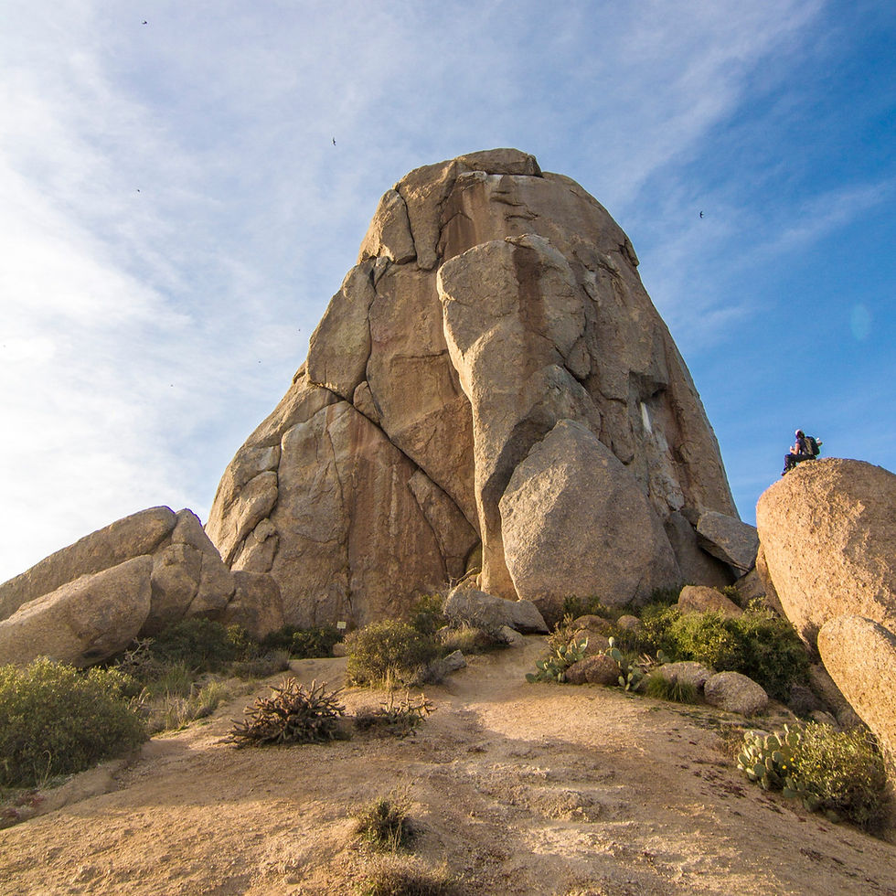
After a few twists and turns, and a little bit of rock scrambling, you will find yourself at your destination, Tom's Thumb! Typically, it's quite crowded here but we got lucky and snagged a few shots before it turned into an Instagram frenzy. The hard work up that incline sure did payoff though, as it's now a great time to eat a snack and capture these views before the sunset!

After you've had a good look at Tom's Thumb, you might want to scramble up a few rocks to get this view as its really quite incredible! From here you can see almost an entire overview of the path you just took, as well as the full panoramic of this side of Scottsdale and the McDowell Sonoran Preserve. You can see my FULL 360 shot over on my Facebook Page. Check it out!

Hopefully after all that you've had a snack, or perhaps a flask with you, as it's time to start the trek back down the way you came. Since we had planned for sunset we waited as long as possible so that the sun was behind Tom's Thumb and glowing on the other side of the valley. As we began our descent, we were presented with these amazing colors! There is nothing like an Arizona desert sunset!

Trailhead address: 500 Back O Beyond Rd, Sedona, AZ 86336
Google Map Coordinates here.
One of the best parts about visiting Arizona other than all of their great hikes and outdoor adventures are all the amazing and colorful sunsets! What's your favorite Arizona hike? Send me a message or leave me a comment below!
Like it? PIN IT!


Comments